Tag: travel

  • My Cross-Country Road Trip

    Mobile device users: this post is best read horizontally.

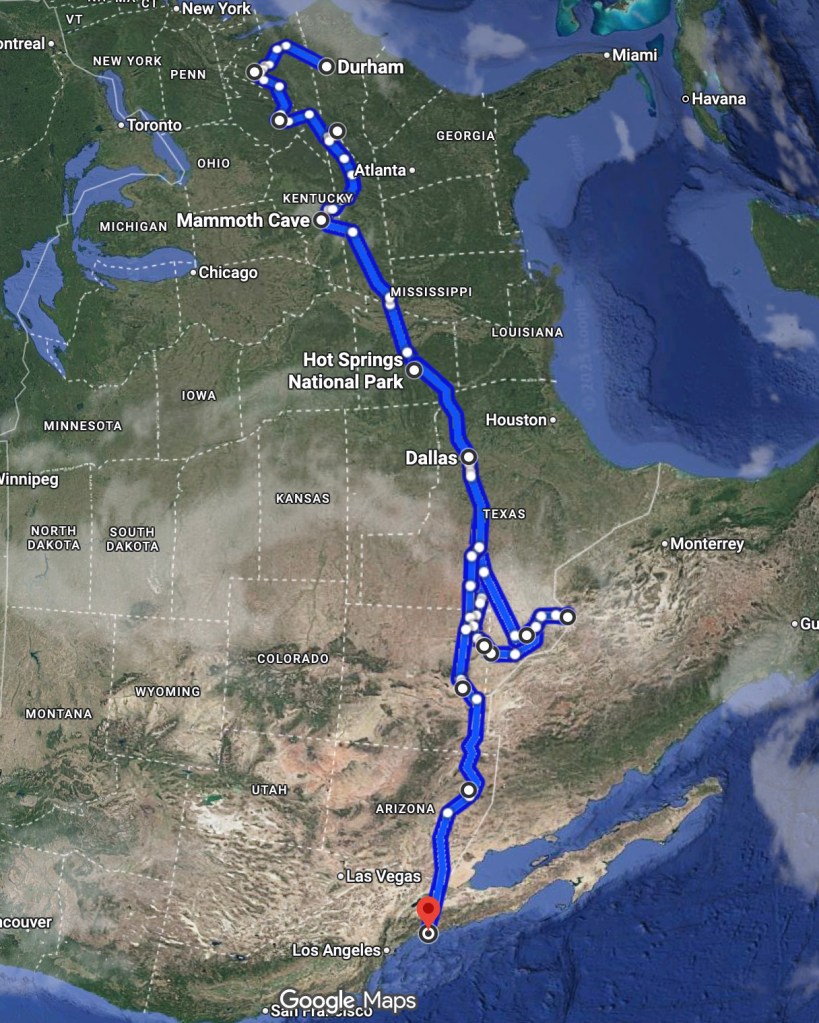
    I recently moved from Durham, North Carolina to San Diego, California. I used this opportunity to take a road trip across the southern United States with my dog. The total driving distance was about 5,000 miles, which we covered in the span of two weeks.

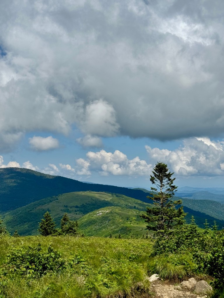
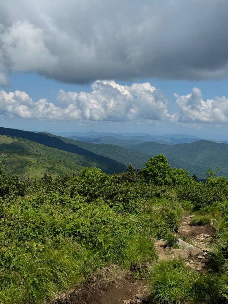
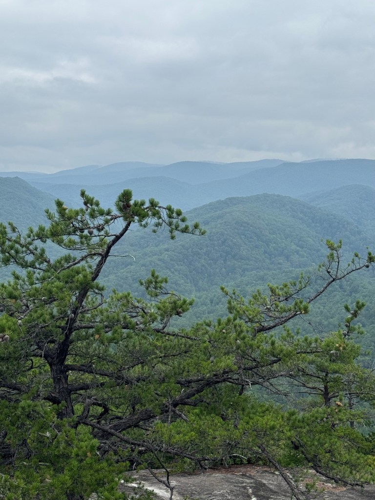
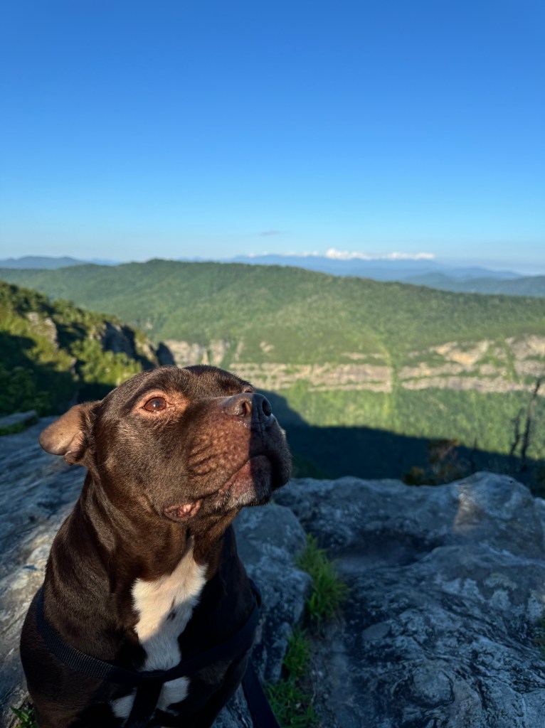
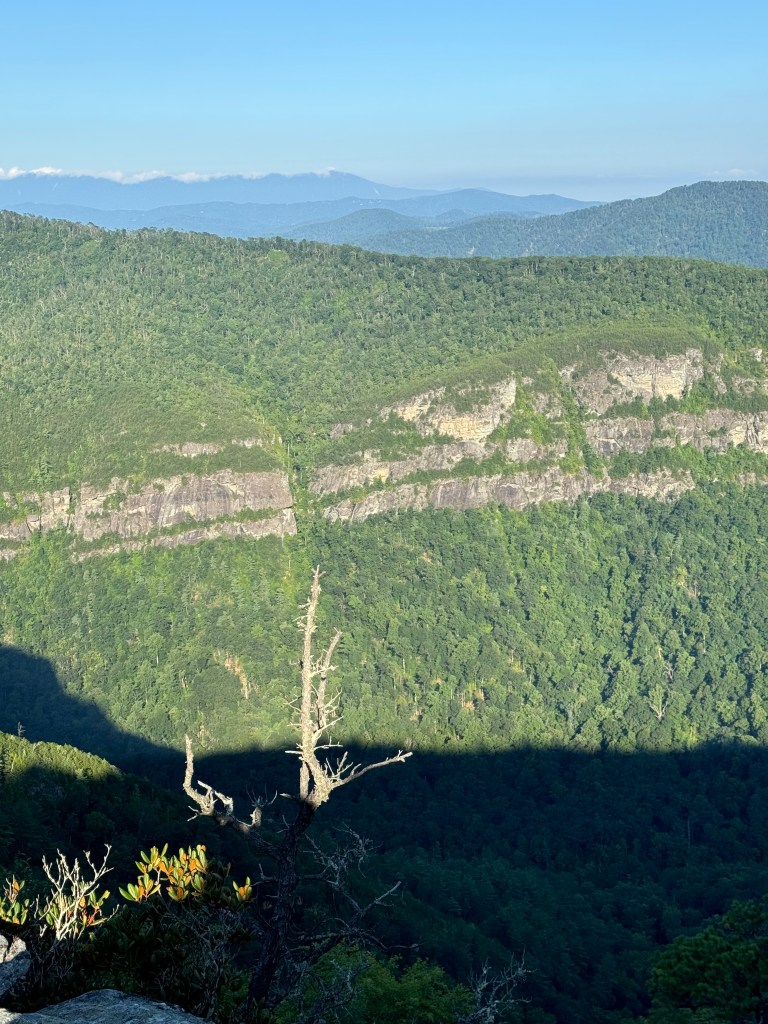
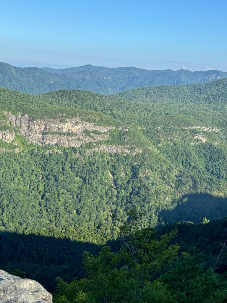
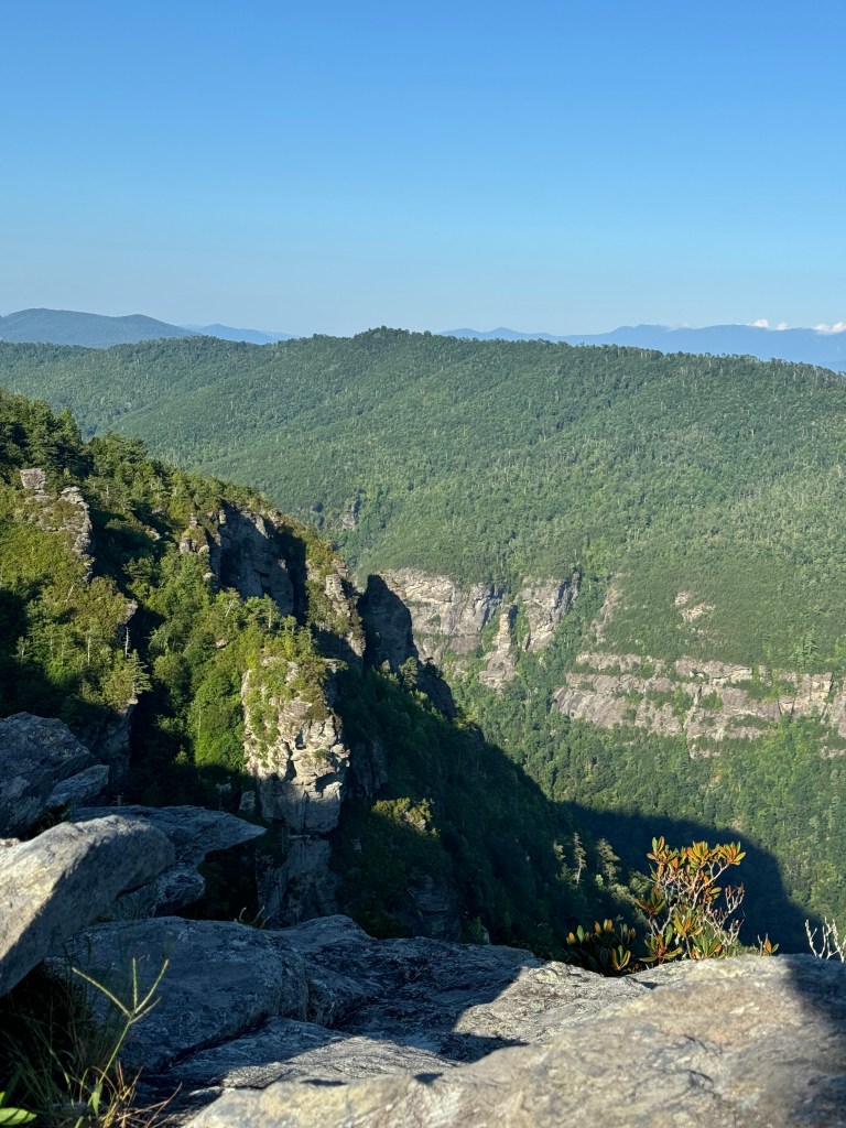
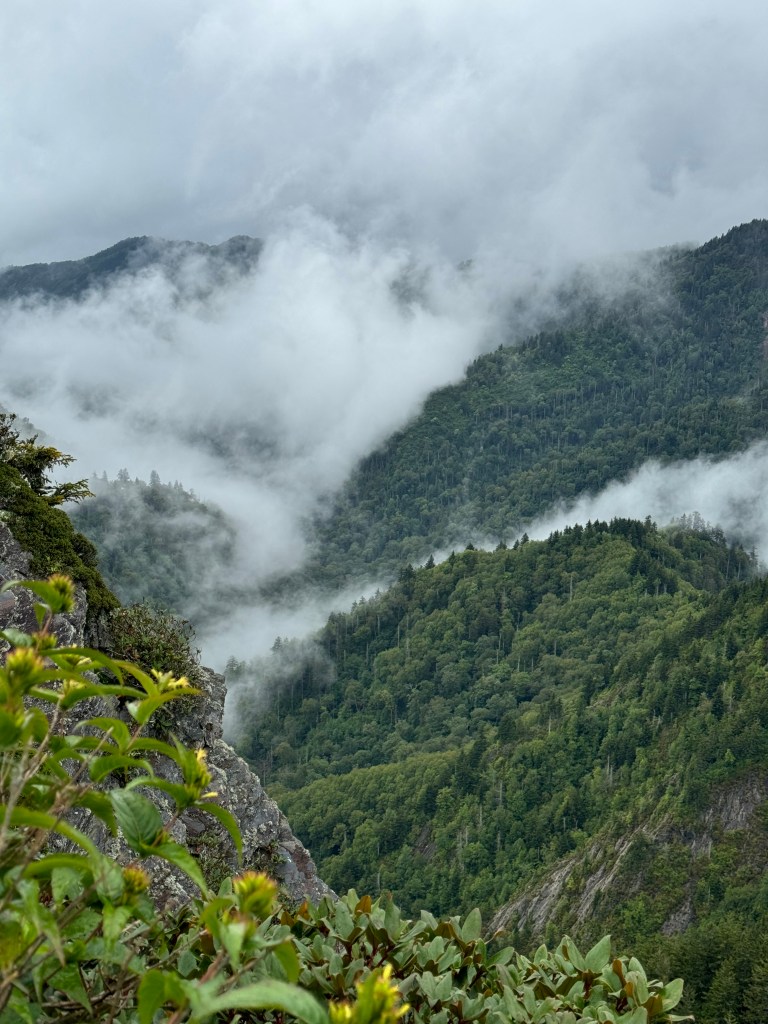
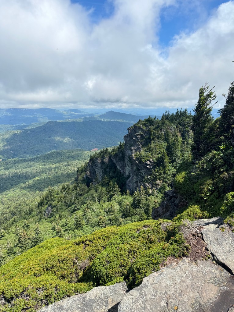
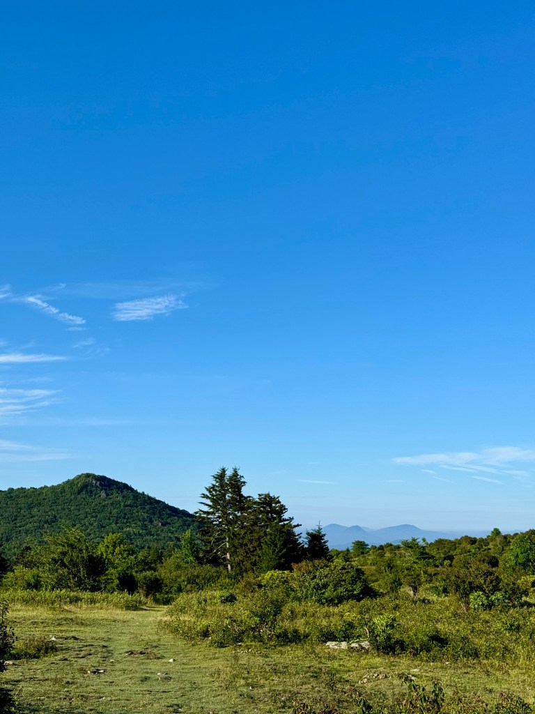
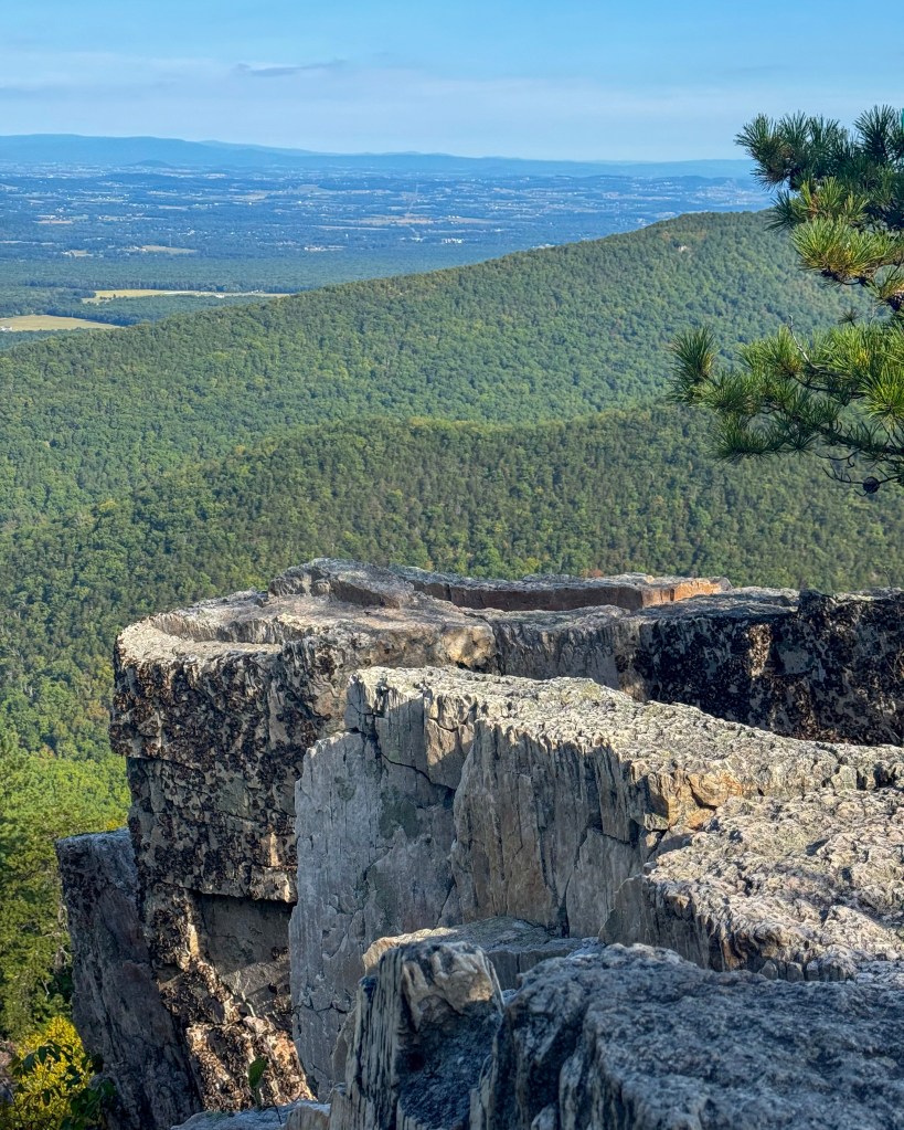
    Our first stop was Shenandoah National Park in Virginia. After catching sunset at the Hawksbill Summit (4049′), Shenandoah’s highest peak, and spending the night in Harrisonburg, we hiked the Riprap – Wildcat Ridge circuit the next day. This strenuous 9.8-mile loop featured several stream crossings, panoramic views at an overlook named Chimney Rock – where this photo was taken – and a final 2-mile stretch along the Appalachian Trail.

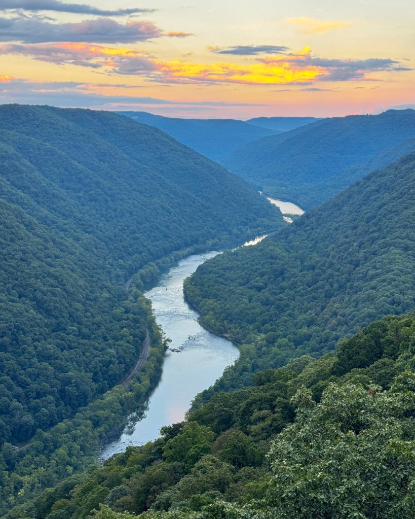
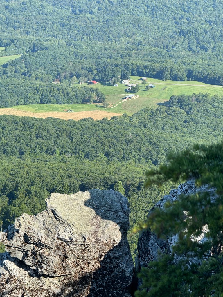
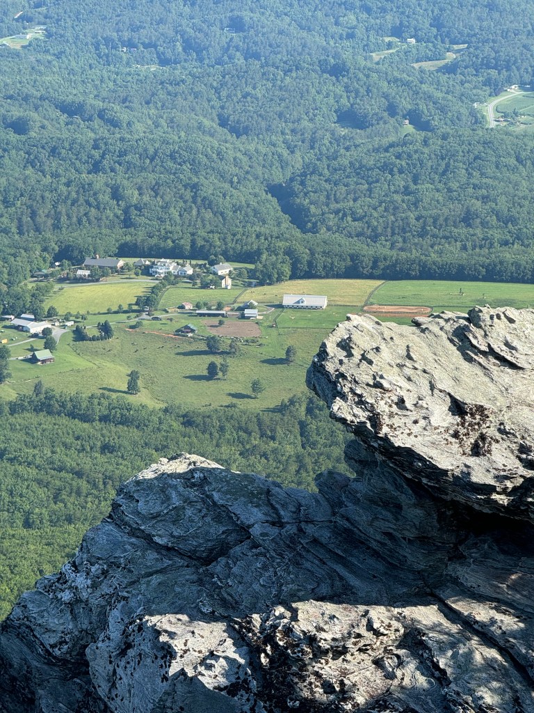
    A 3-hour drive brought us to the New River Gorge National Park & Preserve, located in West Virginia. Re-designated as a national park in 2021, this park protects more than 70,000 acres of land along 53 miles of the New River. As dusk fell, we enjoyed viewing the river from the Grandview Rim and along the Castle Rock Trail.

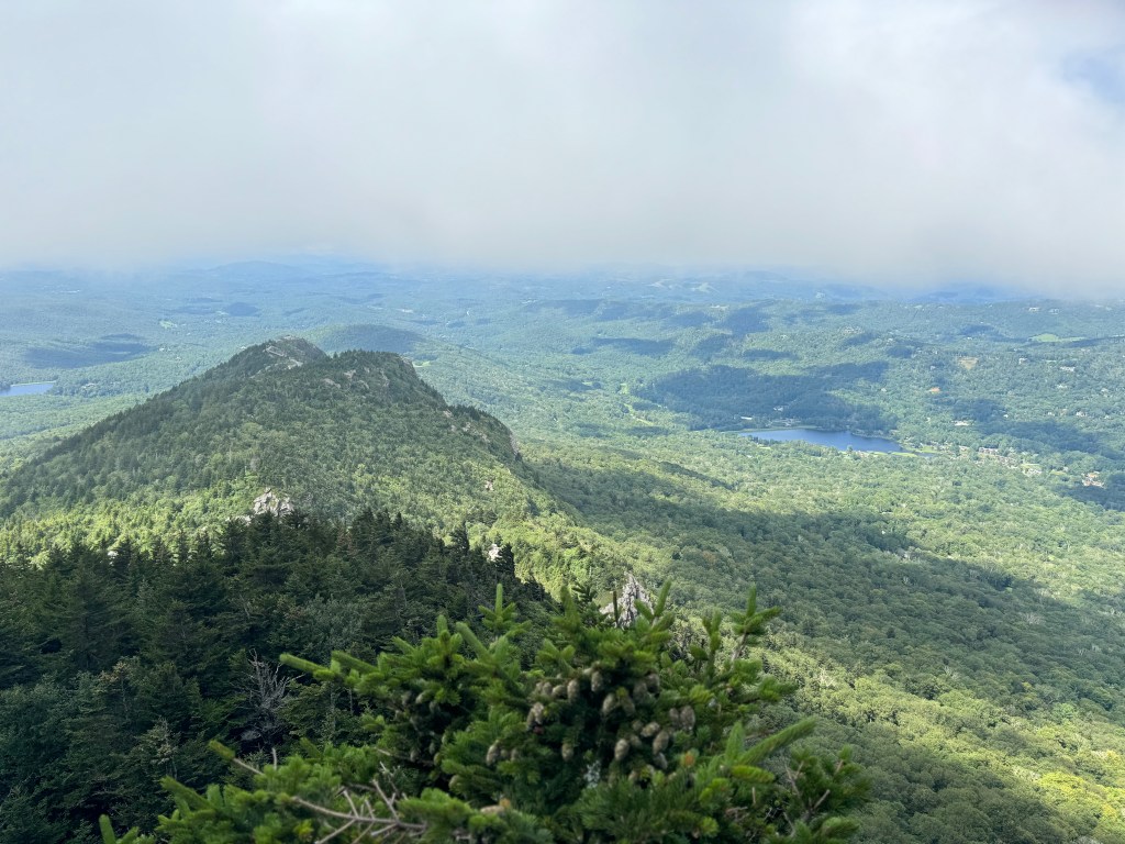
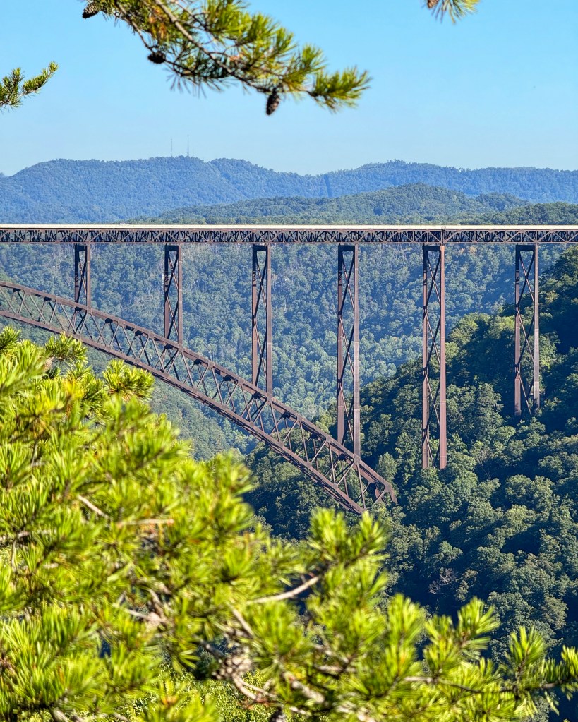
    We spent the night near Fayette Town Park and, from there, hiked the Fayetteville Trail and Long Point Trail to reach arguably the best overlook for the New River Gorge Bridge, the longest steel span in the western hemisphere and no doubt the centerpiece of this national park. It was foggy when we reached Long Point, but the weather soon cleared up, allowing me to take the picture to the right (zoom in to see how tiny a car is in relation to the bridge!).

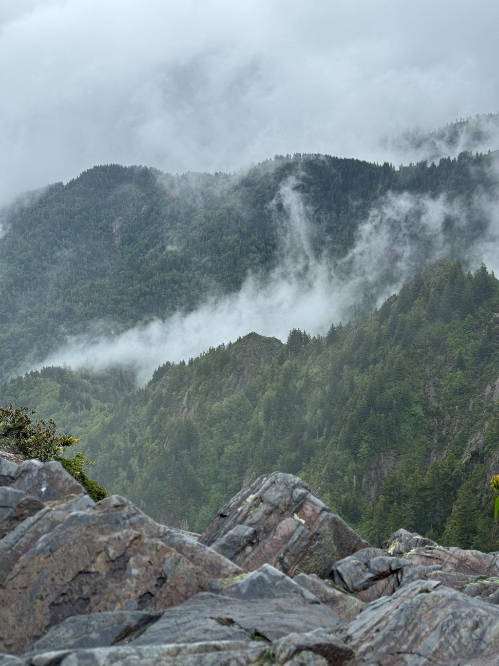
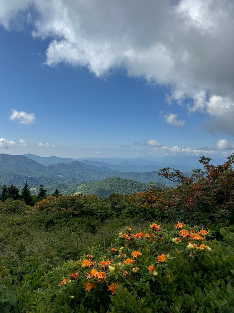
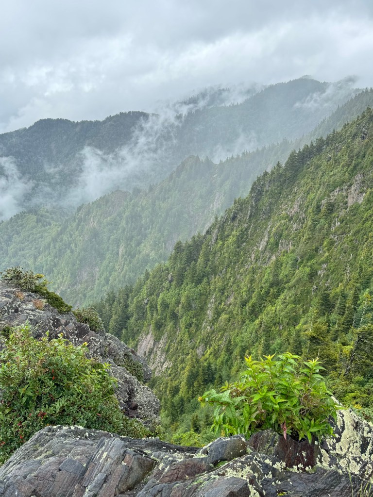
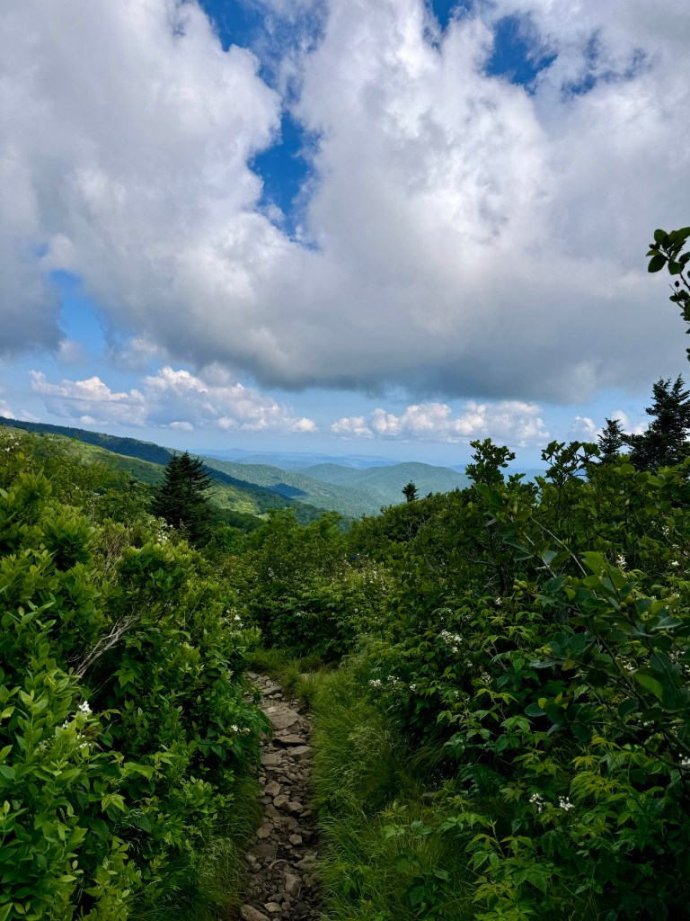
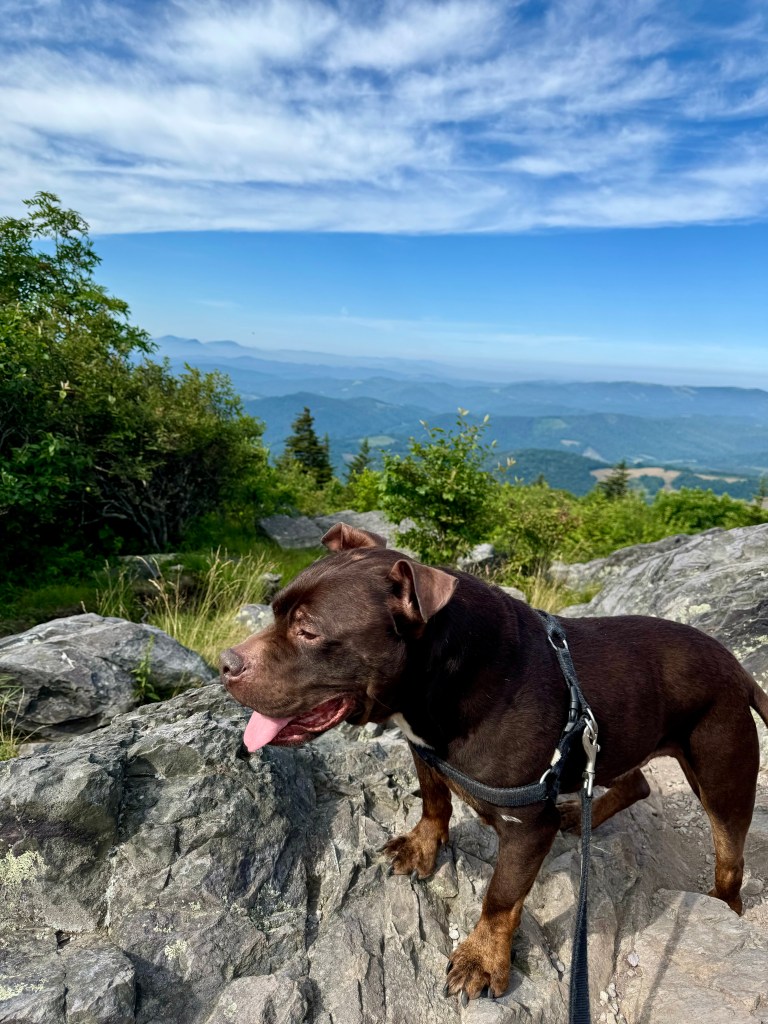
    On day 4, we looped back south to the North Carolina – Tennessee border for a hike through the Roan Mountain. The area has yet to recover from damage caused by Hurricane Helene. It nevertheless remained one of my favorite hiking spots in the high country, not least for its natural population of rhododendrons, which are in full bloom around mid-June. For this visit, We parked at the Carver’s Gap and hiked to the Roan High Bluff (6268′) and Rhododendron Gardens via the Appalachian Trail.

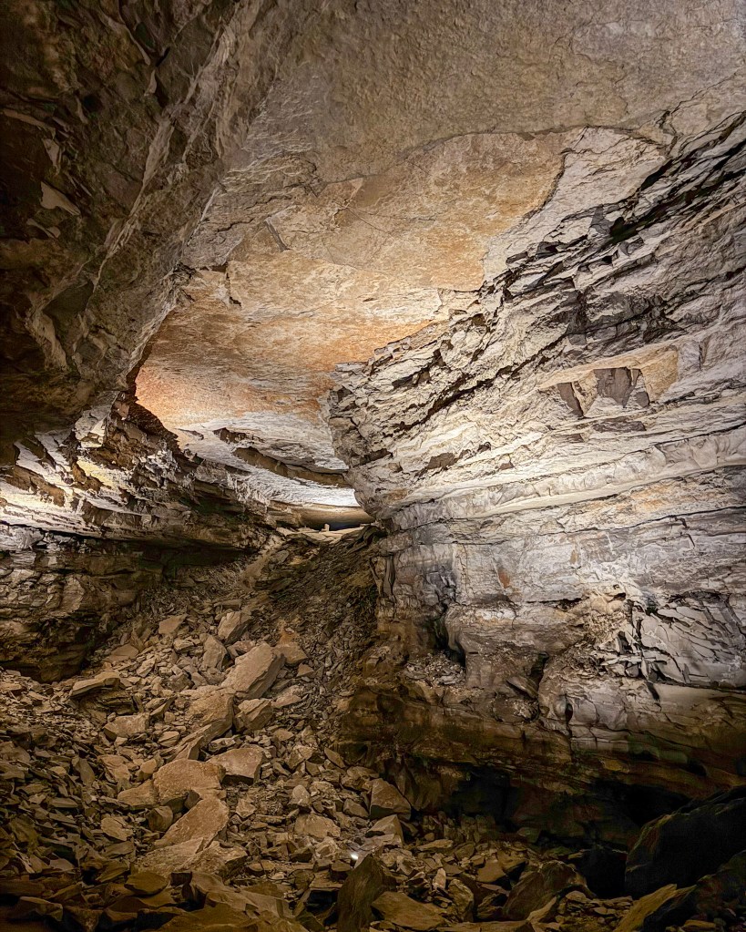
    I did not know Mammoth Cave existed before planning this trip. I was positively stunned when I went on a tour at the Mammoth Cave National Park. Located in Kentucky, it is the longest known cave system, with more than 400 miles of surveyed passageways. The 4-hour Grand Avenue Tour included 4 miles of hiking, stories about the cave’s unique cultural history, and rare views of gypsum formations known as “sunflowers,” “deer antlers,” and “celery stalks.”

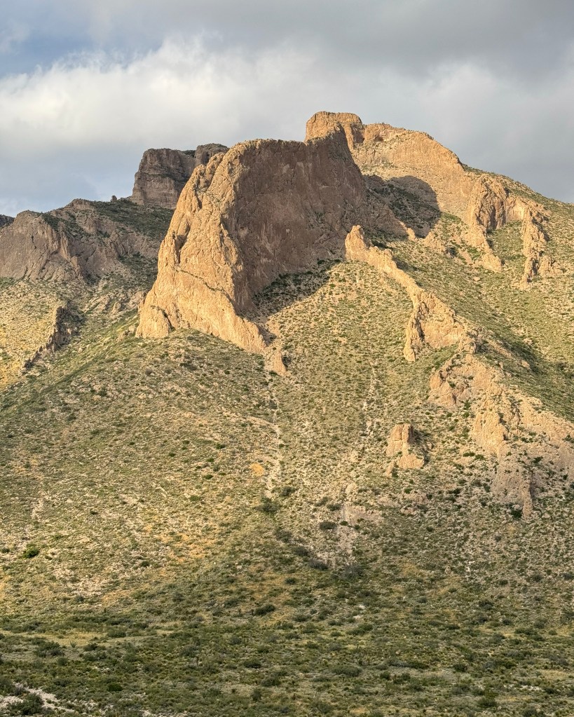
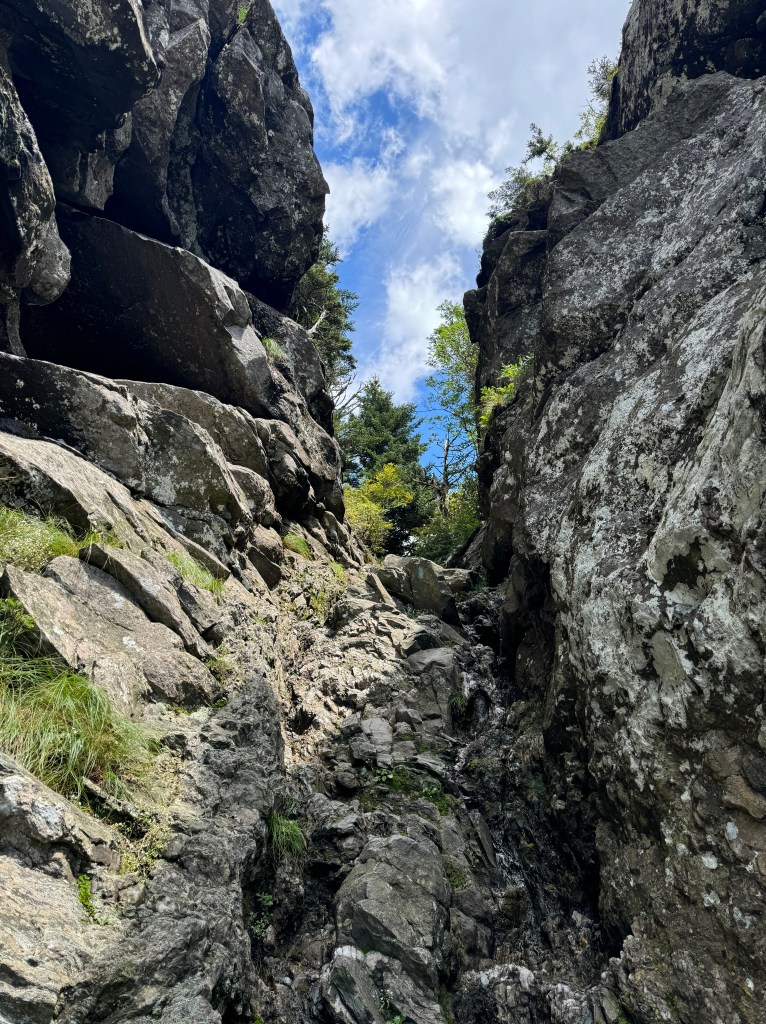
    After driving through Tennessee and Arkansas, visiting my college friend in Dallas, and boarding my dog, I arrived at Carlsbad Caverns National Park in New Mexico. The 1-mile Slaughter Canyon Cave Trail offered a great introduction to the geological and ecological features of the Southwest and hinted at what to come for the next couple of days. After taking this picture, I made my way to the Bat Flight Amphitheater to watch hundreds of thousands of Brazilian free-tailed bats take flight in search of food and water.

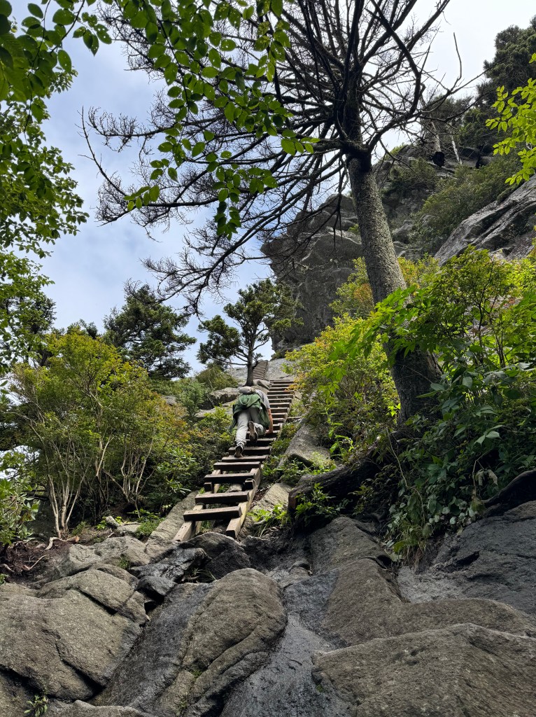
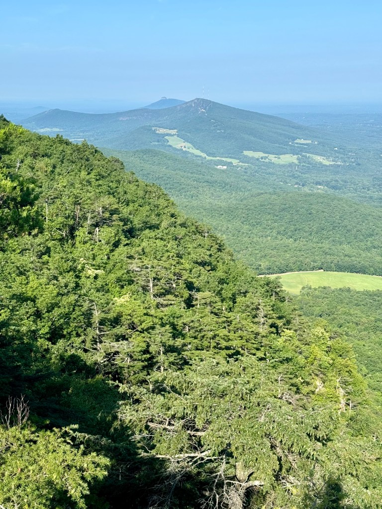
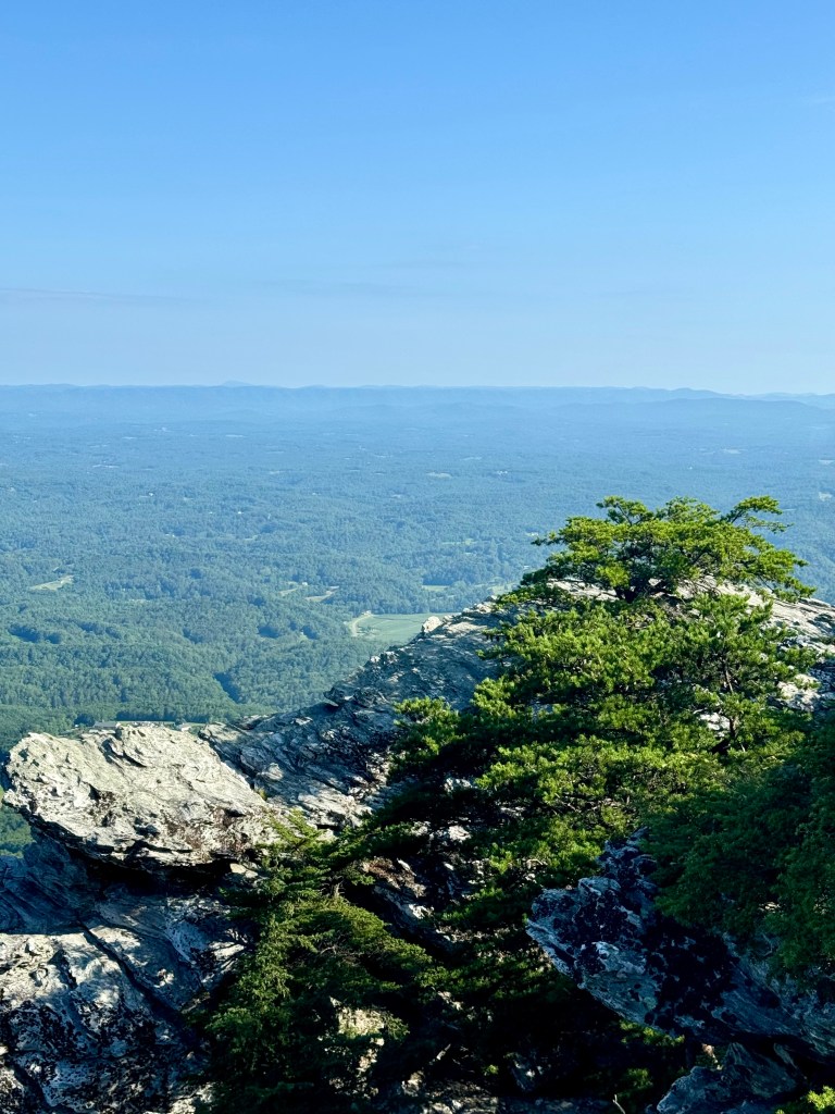
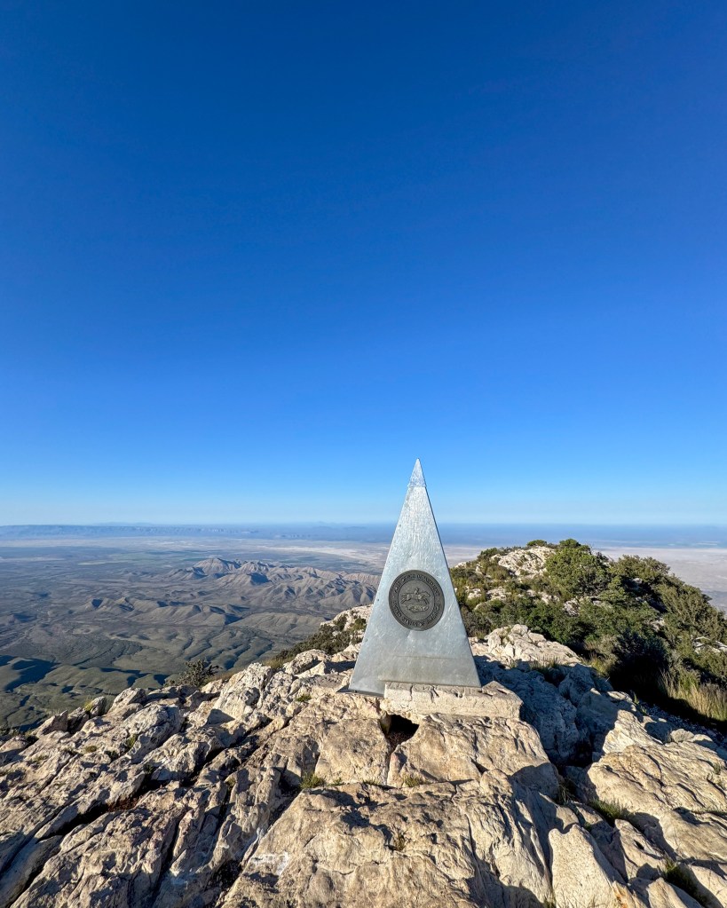
    I celebrated my 22nd birthday on this road trip! The goal was to summit Guadalupe Peak (8751′), Texas’s state high point, via an 8.4-mile hike in the Guadalupe Mountains National Park. I arrived at the trailhead at 5:00AM and, with the help of a flashlight and some courage, reached the peak at around 9:00AM on a windy yet beautifully clear day.

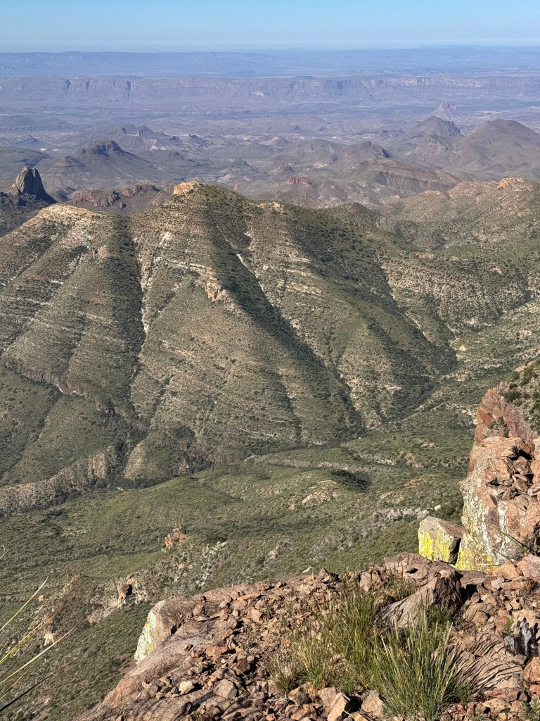
    The next day I challenged myself even further by attempting a 16-mile hike in Big Bend National Park for a comprehensive view of the Chisos Mountains and Basin. This strenuous circuit hike combined the Laguna Meadows Trail, the South Rim Trail, the East Rim Trail, the Boot Canyon Trail, the Emory Peak Trail, and the Pinnacles Trail. I adored the diversity of the flora and fauna here (saw my first wild tarantula!) and would totally come back for birdwatching.

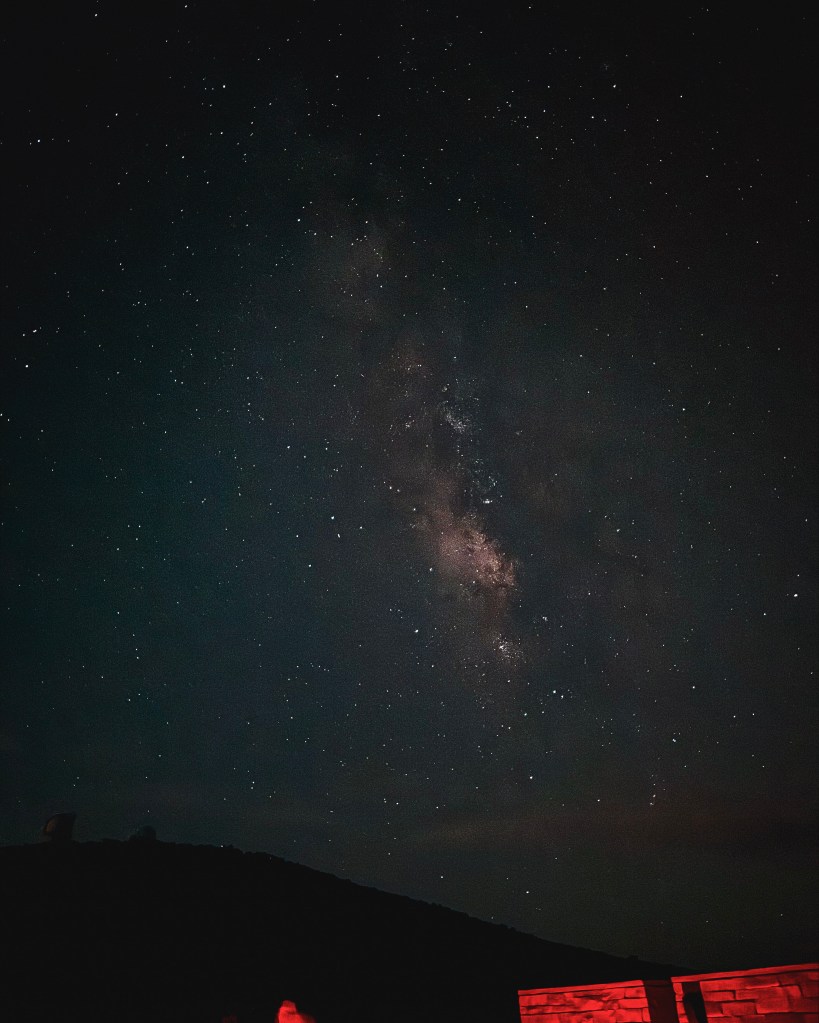
    After the hike at Big Bend, I drove northward to the University of Texas’s McDonald Observatory, located at the core of the largest Dark Sky Certified preserve in the world. I got to view Saturn, a dwarf star, and various young and old galaxies as a participant of their weekly Star Party.

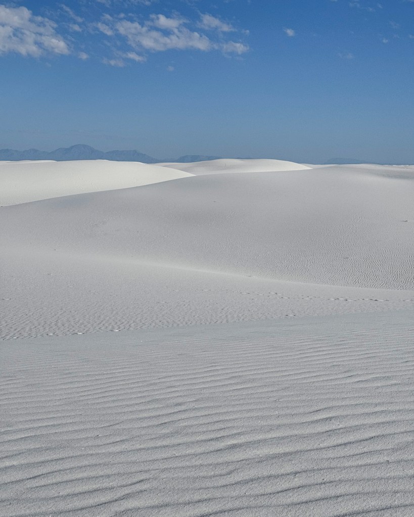
    The road trip was now coming to a close. My dog and I explored the world’s largest gypsum dunefield at White Sands National Park. In addition to being incredibly hot, I remember this park as being a fun playground for my dog to frolic on.

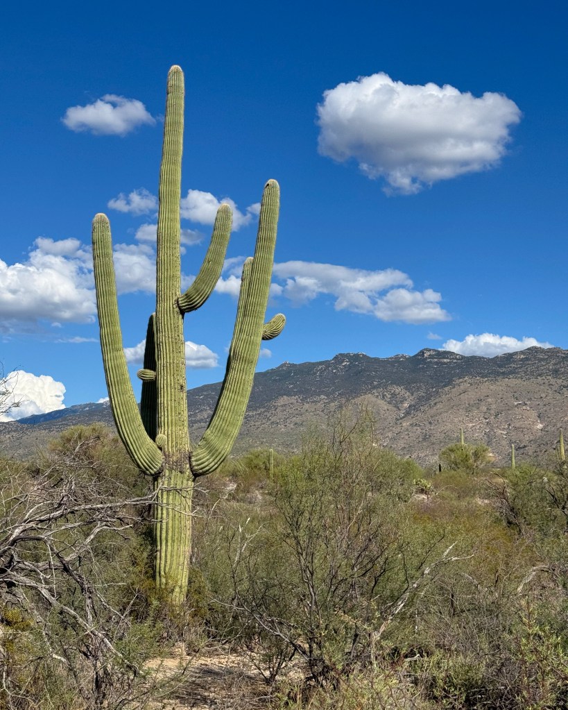
    Our last major stop was Saguaro National Park, which is next to Tucson, Arizona, and named after the tree-like cactus (Carnegiea gigantea) shown in the picture. It was getting unbearably hot for us so we opted for the scenic drive along the aptly-named Cactus Forest Drive and a stroll through the Desert Ecology Trail.

  • Best Hiking Trails in the North Carolina High Country

    Best Hiking Trails in the North Carolina High Country

    I have found hiking in the North Carolina high country to be one of the most exciting experiences of my post-undergrad life. From the stunning scenery to its unique geology1 and cultural history2, I am fascinated by everything Appalachian Mountains. In this blog post, I would like to share five of my favorite summer hiking day trips in the North Carolina mountains. These hikes are arranged in order of difficulty, from moderate (e.g., the Stone Mountain Loop Trail) to strenuous (e.g., the Grandfather Trail). You can use this link to access the list of hikes in Google Maps.

    In addition to documenting my weekend adventures, one of my goals in putting together this list is to make hiking in North Carolina accessible to more people. Hiking is one of the most budget-friendly activities and is, therefore, an excellent option for those looking for affordable forms of recreation. To safely hike these trails,3 which are well-marked and mostly well-maintained,4 all you likely need is water, snacks, a backpack, hiking boots, and, in the case of certain state parks, entrance fees. Most of these trails are dog-friendly: I did every hike with my eight-year-old dog, with the exception of Charlies Bunion and the Macrae Peak, where pets are not allowed.

    Grassy Ridge Bald, Roan Mountain

    Grassy Ridge Bald is a popular destination that sits on the border of North Carolina and Tennessee. It is the first trail I decided to “seriously” hike this summer, and incidentally the easiest. This out-and-back hike starts at the Carvers Gap and follows a 2.5-mile section of the Appalachian Trail, for a total of 5 miles and an elevation gain of about 1,000 feet. The surrounding mountains are covered by rich hardwood forest and abundant rhododendrons. I recommend arriving at the Carvers Gap Trailhead early in the morning because the parking lot fill up quickly.

    Stone Mountain Loop, Stone Mountain State Park

    I remember the 4.5-mile Stone Mountain Loop as a trail that has it all, even on an overcast day. It offers an amazing variety of experiences, including sections that traverse the 600-foot granite dome, beautiful summit views, a waterfall, winding creeks, and a historical farmhouse. To top it all off, I also encountered a couple of raucous Red-headed Woodpeckers drumming and flying in between perches.

    There are two access points to this trail: the Lower Trailhead, which is next to the historical Hutchinson Homestead, and the Upper Trailhead, which is closer to the Stone Mountain Falls. For a slow elevation climb, park at the Upper Trailhead and hike in the counterclockwise direction.

    The Chimneys, Linville Gorge Wilderness Area

    The Chimneys in the Linville Gorge Wilderness features, in my opinion, one of the most stunning sceneries in all of North Carolina. It is usually easily accessible via the Table Rock Summit parking lot; however, at the time of writing, the parking area is closed due to a landslide. I parked at the Hawksbill Mountain Trailhead up north and hiked to the Chimneys via the Spence Ridge Trailhead, Table Rock Gap Trail, and a short portion of the Mountain-to-Sea Trail for a total of 5.8 miles.

    Safety is of the utmost concern when hiking in the Gorge. Trails are not signed or blazed inside the wilderness and can be difficult to navigate, not least due to the rugged terrain. It is, therefore, important to bring a map of the area and adequate water. Also note that the forest service road leading up to the wilderness area is unpaved and quite challenging to drive on.

    Charlies Bunion, Great Smoky Mountains National Park

    Charlies Bunion” describes a rock formation named after a local Appalachian Trail supervisor, Charlie Conner, who presumably hiked the trail with worn-out shoes, and features panoramic mountain views. My friend and I hiked 8 miles roundtrip from the Newfound Gap along the Appalachian Trail, traveling through high-elevation, spruce-fir forest on a rainy Wednesday.

    Calloway Peak, Grandfather Mountain State Park

    The Grandfather Trail is one of the most technically challenging hikes in North Carolina and perhaps on the entire east coast. This 4.8-mile out-and-back trail follows the ridge of the Grandfather Mountain from the Top Shop Parking Area, passing through the Macrae Peak (5845 ft) and the Attic Window Peak (5880 ft), to the Calloway Peak (5946 ft). It is an incredibly fun and rewarding trail for more experienced hikers: the steepest sections of the trail require the use of in-place cables and ladders, and there is a fair amount of rock scrambling involved.

    I found this trail quite strenuous and, as someone who is working on his fear of heights, nerve-racking at times, but nevertheless highly rewarding and doable with previous hiking experience. My friend and I started hiking at 10am, and it almost took us the entire day to complete the trail (it is said that even the best hikers only average about a mile per hour). More logistical detail about this trail can be found on the Grandfather Mountain website. While no special equipment is required for this trail, it is essential to bring a pair of hiking boots with solid traction. Note, also, that the Grandfather Mountain State Park charges an entrance fee of $28-32 per day for each adult during summer months.

    Footnote

    1. For an engaging introduction to the geological history of North Carolina mountains, see Sandra Clark’s Birth of the Mountains: The Geologic Story of the South Appalachian Mountains (U.S. geological survey, U.S. Department of the Interior, 2001). ↩︎
    2. The Cherokees were the largest southeastern tribe by the sixteenth century. For an introduction to the social history of the Cherokees, see The Cherokee Perspective: Written by Eastern Cherokees, pp. 3-114 (Appalachian Consortium Press, 1981). ↩︎
    3. For hiking basics, visit this excellent blog post on understanding mileage, elevation, and routes, this post on beginner hiking gear, and this one on trail etiquette. ↩︎
    4. Conditions at many trails in western North Carolina have changed due to damage from Hurricane Helene. Notably, the Mount Mitchell State Park remains closed indefinitely (as of August 2025) and is thus not included in this list. ↩︎
  • State Parks Are Underappreciated

    This summer, I’ve been in the habit of visiting state parks in the high country and piedmont region of North Carolina. I would make the drive from Durham on Friday evening and get a couple hours of sleep in before starting the hike early in the morning. Part of the reason for this kind of schedule is to help me and my dog get used to crashing out in the car for our big road trip in September.

    I’m starting to realize just how amazing and underrated some of the state parks are in North Carolina. They don’t have the prestige of National Parks but can be just as rewarding to visit. I wanted to share three parks that have stood out to me thus far: Hanging Rock in North Carolina, Roan Mountain on the North Carolina-Tennessee border, and Grayson Highlands in Virginia.

    Hanging Rock is located 30 miles north of Winston-Salem, next to a small town called Danbury. We avoided the popular Hanging Rock Trail (1.3-mile one way) and instead opted for the moderately challenging and arguably more rewarding Moore’s Wall Loop Trail (4.7-mile loop), which leads to Moore’s Observation Tower (2497 ft). Remember to hike the loop in the clockwise direction if you would like a slow elevation climb. We hiked counterclockwise and was confronted with the 684-step “endless staircase” climb from the outset.

    Roan Mountain is covered by rich hardwood forest and abundant wildflowers. For an easy-to-moderate out-and-back trail, park at Carvers Gap Trailhead (go early because spots fill up super fast) and hike to Grassy Ridge Bald (6,184 ft). This route is part of the Appalachian National Scenic Trail.

    For wild ponies and scenic views, visit Grayson Highlands State Park, which is located next to Virginia’s two highest mountains, Mount Rogers (5729 ft) and Whitetop Mountain (5525 ft). We loved hiking around the Massie Gap, where we encountered the resident herd of ponies.

    My dog had been having joint pain but was able to comfortably finish the hikes with me after getting treatment at the vet. So our plan is to do mountain hikes of increasing difficulty. We are planning to visit Crowders Mountains near Charlotte, Mount Pisgah near Asheville, and Chimney Rocks (recently reopened after hurricane damage). I’m also planning to hike Table Rock Mountain and Grandfather Mountain before I leave for San Diego.